Who doesn't love Google Earth? A great way to spend time looking at far-flung destinations, or just into the neighbor’s garden.
But Google Earth Studio is something different, a powerful tool that allows users to animate content in this 3D world. Sounds great, but how useful is this in the real world?
In this blog post, we will explore three ways that we use Google Earth Studio as part of our production process. Google Earth Studio has a lot to offer video producers. Read on to learn more about how to use this tool to take your video production to the next level.
Storyboarding aerial shoots
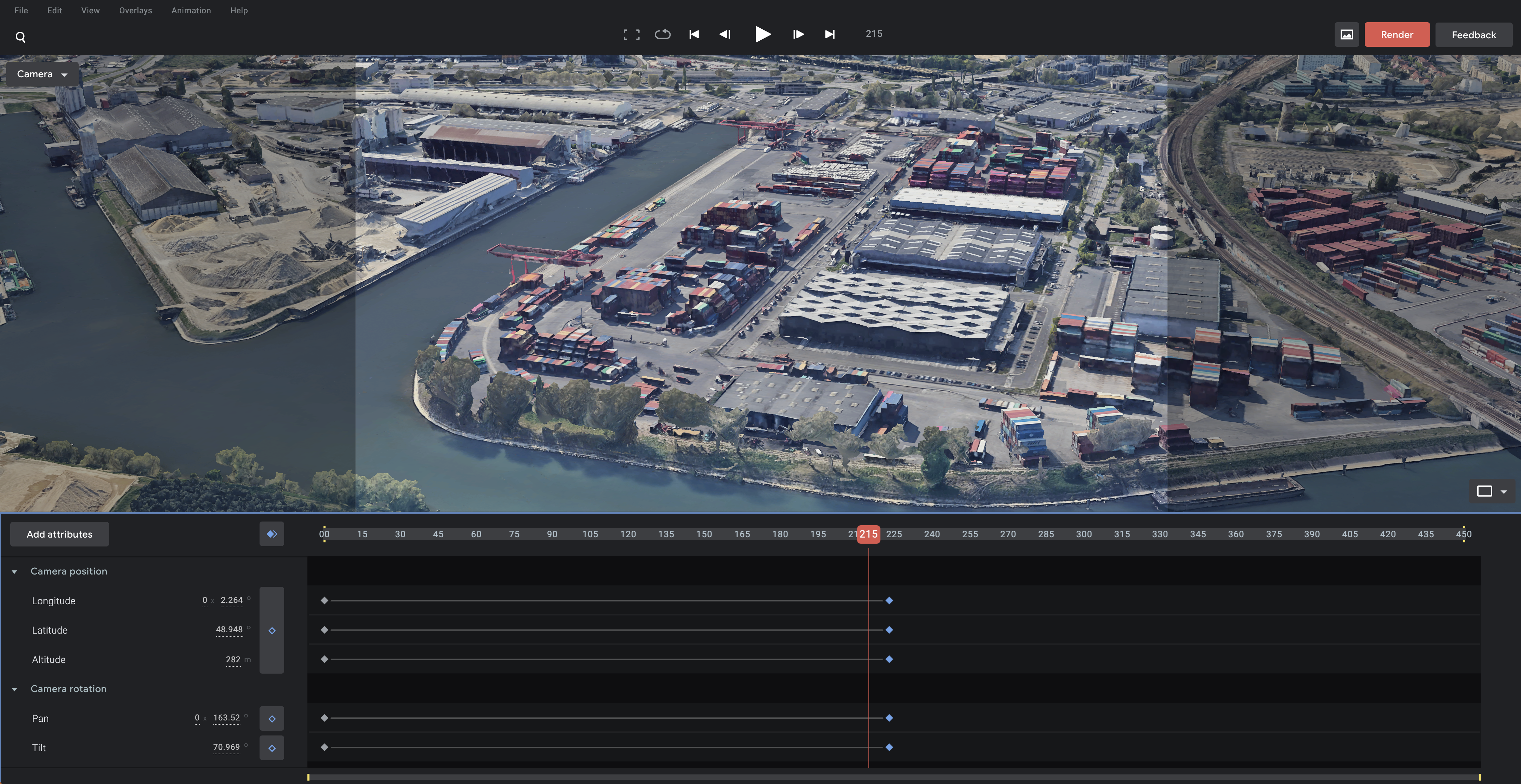
Aerial footage raises the production value of any video, but filming from the air is expensive and poses all sorts of challenges. It's therefore imperative to be well prepared and have a clear idea of what you want to capture before you’re airborne. We’ve been using Google Earth Studio to storyboard and plan aerial shoots. The platform lets you create "camera paths" so you can plan exactly how your camera will move through the scene. This is incredibly helpful for figuring out things like composition and framing but also the all-important camera moves to give us that dynamic and cinematic shot.
These animated fly-throughs of our planned shots helps us communicate our vision to the rest of the production team and the client. Plan, camera, action!
Use renders as B-roll footage
While not suitable for every video project, there are occasions where the use of the renders from Google Earth Studio can be used as B-roll footage in an edit. This can be a great way to add some extra interest and dimension to your videos, where live-action aerials aren't possible. The entire world is yet to have high-res 3D imagery captured, but many major cities do. We put this to use for an internal project for The Crown Estates. We needed some clips...
.gif?width=632&height=356&name=ezgif.com-gif-maker%20(1).gif)
Location recces
Google Earth Studio is the perfect tool for planning a video shoot. With its satellite imagery and 3D mapping capabilities, you can get a feel for the lay of the land and plan your shots accordingly. Plus, its easy-to-use interface makes it a breeze to get started.
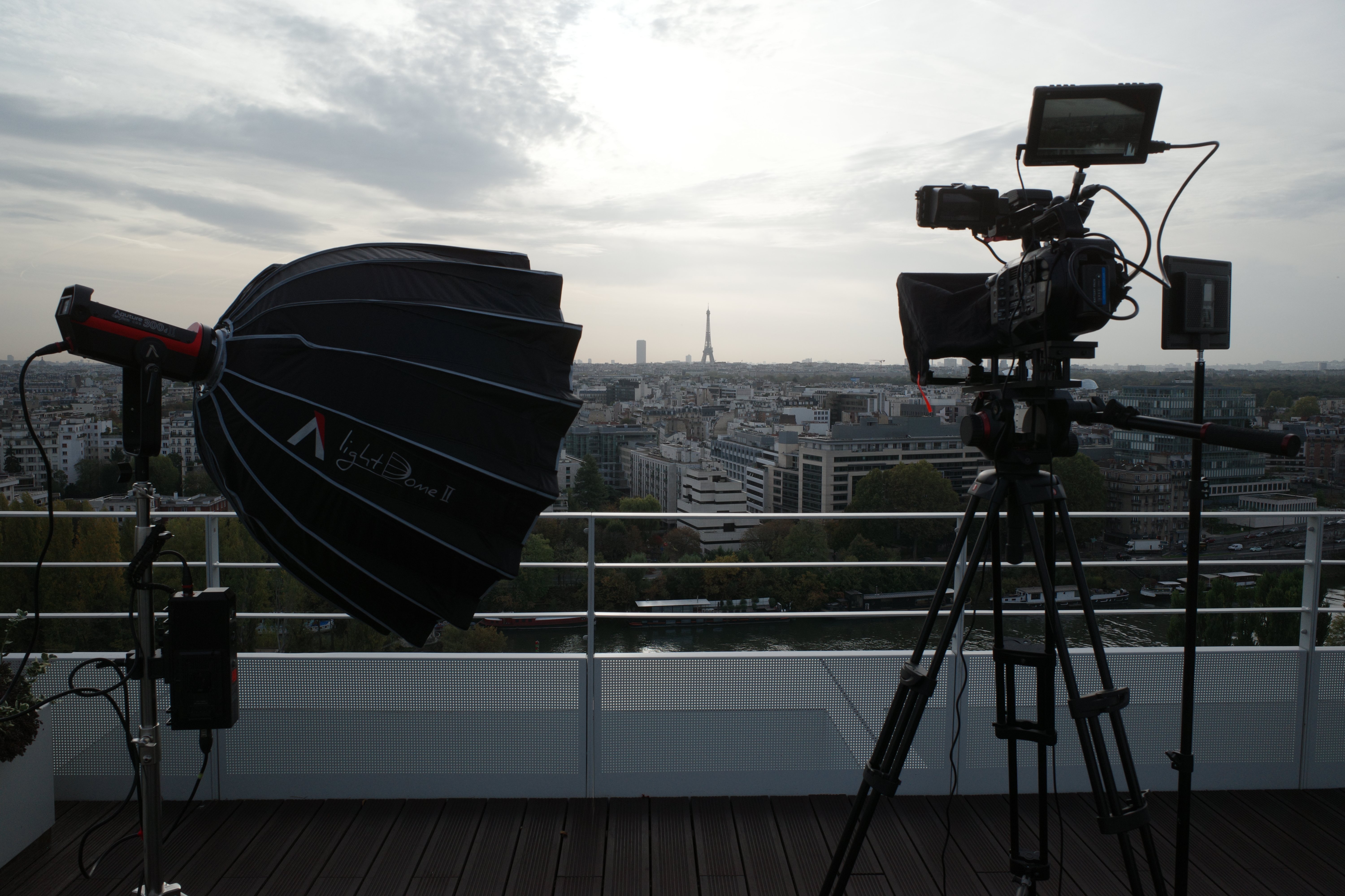
For location scouting, Google Earth Studio is an invaluable resource. We recently had a shoot in Paris. The rooftop interview looked great but some b-roll of a port was really going to provide context and make for a more engaging video. Not being familiar with ports around Paris we were able to work out where and how we could get the shots we’d need.
This is especially helpful when filming in remote or difficult-to-access locations, as we can scout out the terrain beforehand and identify any potential hazards.
If you're not familiar with Google Earth Studio, here's a quick rundown of how it works:
- First, you select a location.
- Then, you use the various tools at your disposal to examine the area in detail. You can zoom in and out, rotate and tilt your view, and even switch between different types of map views (satellite, street view, etc.).
- Once you’re happy with the framing of your scene you plot keyframes to set the camera movements and angles.
- You can then render it as a video file to be imported into your video editing software.
Overall, Google’s Earth Studio is a great tool for any video producer or director who wants to do location scouting or plan out and get the most out of an aerial shoot.
Make sure to subscribe below to get more insights and updates from BearJam!